01.20.11
Posted in Weather Education, Weather Myths at 8:00 am by Rebekah

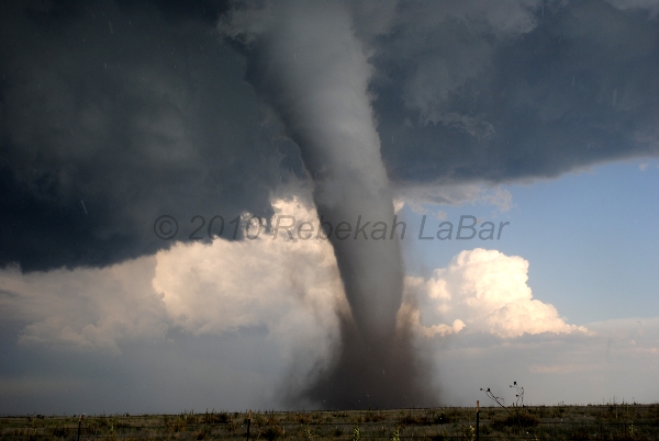
Here are a few myths about tornadoes that you might have heard.
- Myth: “You should open windows to equalize air pressure.”
- Fact: Although tornadoes may have a low pressure center, houses are well-ventilated and pressure differences would be equalized well before explosive pressure drops came close enough to the house. Opening windows is a waste of time and may just bring more flying debris into your home.
- Myth: “You should always shelter from tornadoes in the southwest side of your house.”
- Fact: Tornadoes often come from the southwest, which is possibly related to how this old myth got started. Instead, you should hide in the center of your house, in a closet, underneath heavy furniture, or under a stairwell.
- Myth: “A highway overpass is a good tornado shelter.”
- Fact: Although a TV station video from Kansas in 1991 showed that people got apparent protection under an overpass, they were just providentially spared (not to mention the tornado did not come directly over them, as presumed). An overpass actually creates a wind tunnel effect, such that the winds under the overpass can actually be even stronger than the winds in the tornado. You would also be directly exposed to flying debris. People have been killed hiding under overpasses (most notably on May 3, 1999 in Oklahoma City). Instead, if you are in a car and a tornado is nearby, you should drive away, if possible, or take shelter in any nearby buildings (staying inside a stationary car is not a good idea).
- Myth: “My town is protected from tornadoes by a river, hill, valley, Indian burial ground, etc.”
- Fact: The idea that your town is protected is a combination of perhaps wishful thinking, a short memory, and the rarity of tornadoes. Tornadoes don’t care about surface features, though, they are more driven by what’s going on aloft. When I moved to Norman, I heard that there was a “bubble” or “dome” that seemed to keep tornadoes in Oklahoma City but not Norman. Norman had been struck by tornadoes in the 70s and 80s, but not for a while. Well, the so-called “bubble” was popped recently, as east Norman was hit by a tornado in June 2009 and again by an EF4 tornado in May 2010.
Follow Green Sky Chaser on Twitter and Facebook for weather, chasing, and blog updates.
Permalink
12.27.10
Posted in Weather Education, Weather Myths, What If at 10:01 am by Rebekah

Have you ever heard of weather modification?
Has anyone told you (or have you thought) that we would be doing society a favor if we could figure out how to prevent destructive storms such as hurricanes and blizzards from happening?
What do you think the earth would be like if we didn’t have these storms?
Here’s my take on this question.
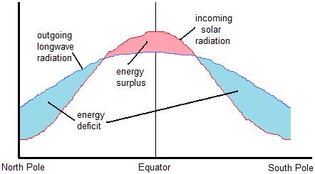
Due to the earth’s tilt, the sun heats the earth unevenly. The tropics receive more direct solar radiation than the poles.
Some of this radiation is absorbed by the earth, which subsequently emits longwave radiation back to space. The tropics, as you might guess, emit more radiation than the poles.
Now, the tropics receive more solar radiation than is emitted by the earth at the tropics…but the poles emit more radiation than they receive. This means the tropics have a net surplus of radiation and the poles have a net deficit of radiation (see figure, below).

Earth's Annual Radiation Budget
Left unchecked, this radiation imbalance would result in the tropics growing increasing hotter, and the poles growing increasing colder!
Now enter fronts, winds, high and low pressure systems, and smaller-scale thunderstorms.
Whenever something is out of balance, the earth (or atmosphere) tries to balance it out somehow. Thus, warm air must be transported towards the poles and cold air must be transported towards the tropics. An extratropical cyclone (a low-pressure system in the mid-latitudes) and its associated cold and warm fronts forms to restore equilibrium to the earth’s temperature differential.
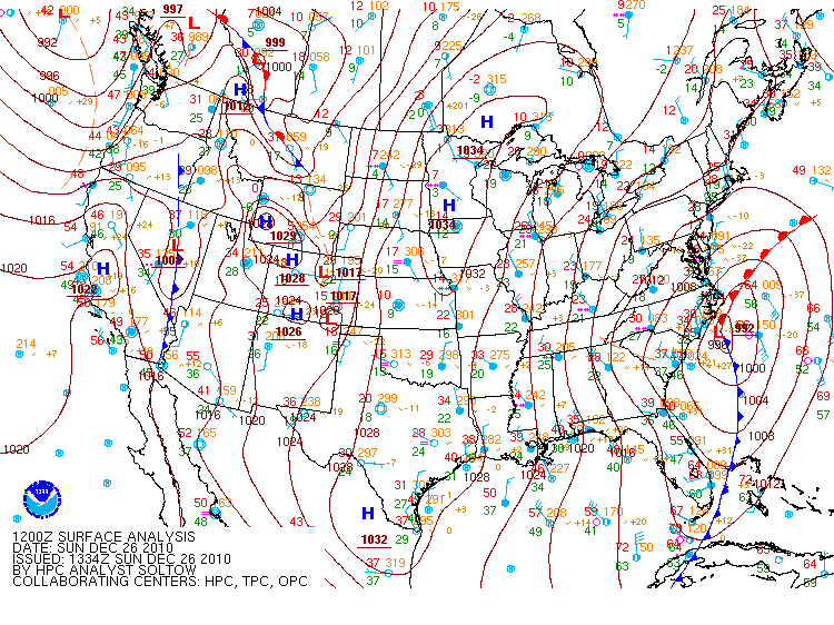
See yesterday’s surface analysis from the Hydrometeorological Prediction Center for an example of this balancing act (click to enlarge):

- Take a look at the red “L” off the coast of North Carolina. This indicates the center of the low pressure system responsible for the ongoing blizzard in the Northeast.
- Lows spin counter-clockwise in the northern hemisphere (opposite in the southern hemisphere), thus there are north and west winds that are coming around and pushing a cold front (blue line with triangles) southeastward.
- Note many temperatures (indicated by red numbers) are in the 30s behind the front.
- South-southeast winds are wrapping around the eastern side of the low, behind a warm front (red line with semi-circles) lifting northwestward.
- Note the temperatures behind the warm front are in the mid-60s.
Note also that these large extratropical cyclones usually have smaller storms that form along the fronts and/or around the low (e.g., snowstorms and/or thunderstorms). These smaller-scale storms are also attempting to balance an aspect of the environment that is out of balance. Hurricanes are another animal, but are similarly large low-pressure systems (minus the fronts) that help to balance things out.
All that to say that if we did not have weather, including occasionally severe weather, we might be in even more trouble. There is no way to stop the earth from trying to continually balance itself, but if somehow we could, the earth might soon be unlivable.
What do you think about weather modification or what the earth would be like without severe weather?
Permalink
03.25.10
Posted in Weather Myths at 2:21 pm by Rebekah

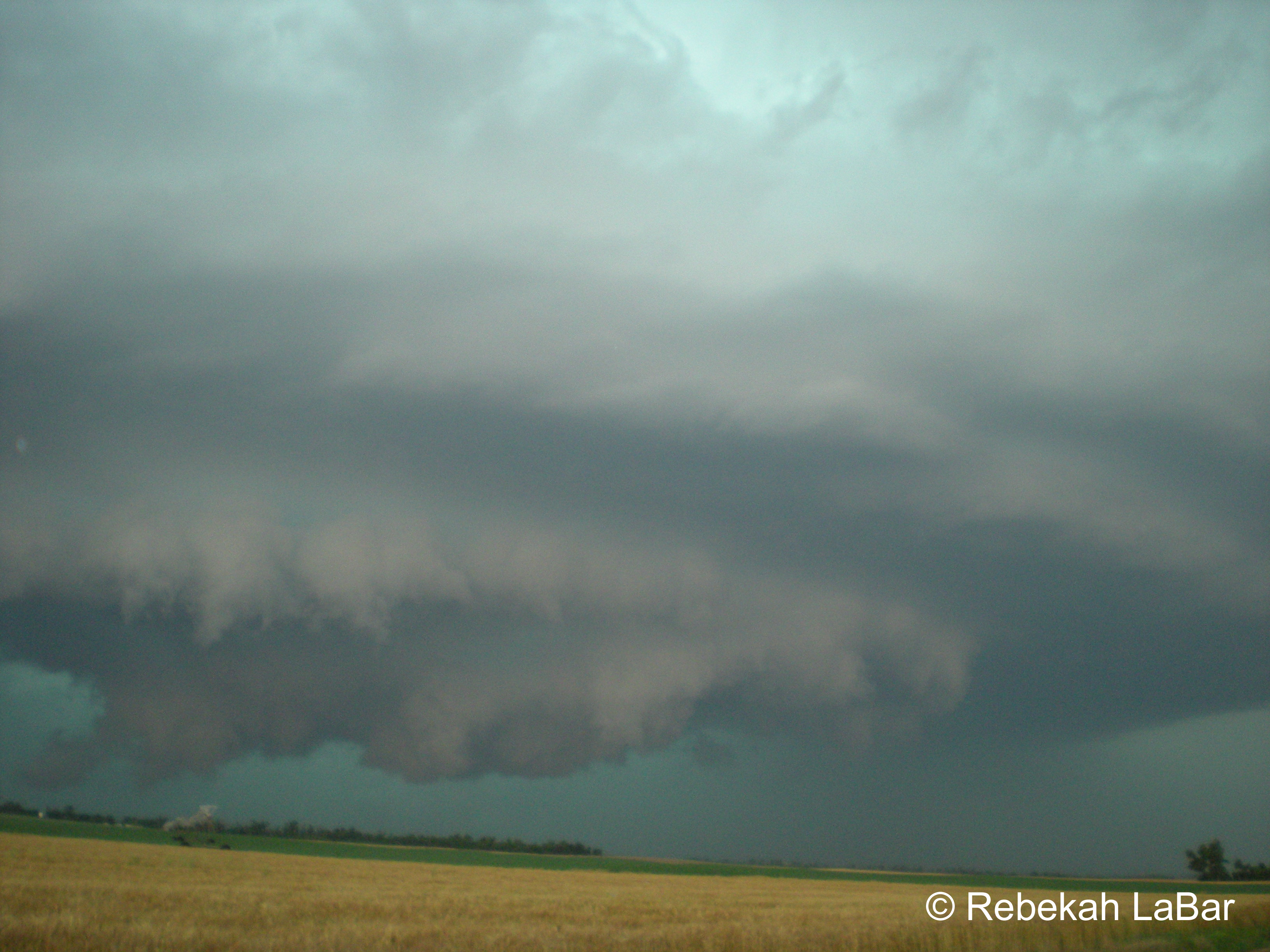
Have you ever heard that when the sky turns green, it means a tornado is coming?
This saying is an oft perpetuated myth, especially in the central US. Truth be told, no one knows for sure what causes a green sky to form. Somehow it’s not a high priority in science right now. 🙂 One thing we do know, though…green skies are often observed with severe thunderstorms, but the sight of a green sky by no means indicates that a tornado is about to form or large hail is about to fall.
Although we are not sure what the exact mechanism is behind the green sky (there are multiple theories you can find on the Internet; some have more credibility than others), the color is likely a result of the liquid water and hail in some strong thunderstorms. Water absorbs and re-emits longwave radiation very well. In fact, water vapor contributes to the greenhouse effect more than any other gas in the atmosphere. One theory is that when sunlight reaches the water droplets and ice within a thunderstorm, the red light is absorbed somewhat, while the green light is reflected back to our eyes. The heavier the precipitation, perhaps the greater the color green.
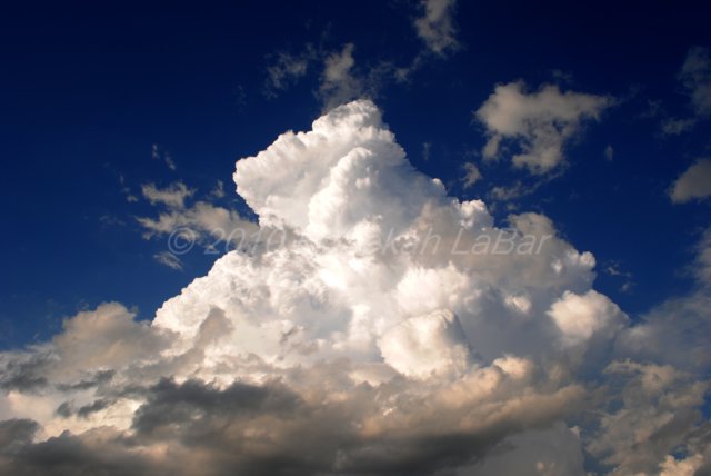
I chose the name “Green Sky Chaser” for my website and blog because I love the color green. My favorite color of all is a combination of green, blue, and gray: the practically indescribable, pale turquoise color of a stormy sea, and best of all the awe-inspiring color of the sky during some amazing severe storms. I have witnessed several brilliant, blue-green skies while storm chasing (see photo, above; for more photos from my storm chasing adventures, see my website). To me, a green sky means ominous, breath-taking beauty. Tornadoes are not my sole purpose for chasing; the sight of a tornado may be the icing on the cake, but I’d travel many miles just to see lightning, hail, amazing storm structure, and an awesome green sky.
Permalink
