12.29.10
The Atmosphere’s New Year’s Resolution: CHANGE
So far for the month of December:
Seattle, Washington has had 8.59 inches of rain (3.65 inches above average).
Denver, Colorado has had NO SNOW (16.4 inches below average); in fact, no precipitation at all (0.55 inches below average).
Newark, New Jersey has had 3.87 inches of precipitation (0.78 inches above average), including 24.5 inches of snow (22 inches above average). [As an aside, check out this 40-second time lapse video from 20 hours of the blizzard in New Jersey on Sunday…it’s very impressive!]
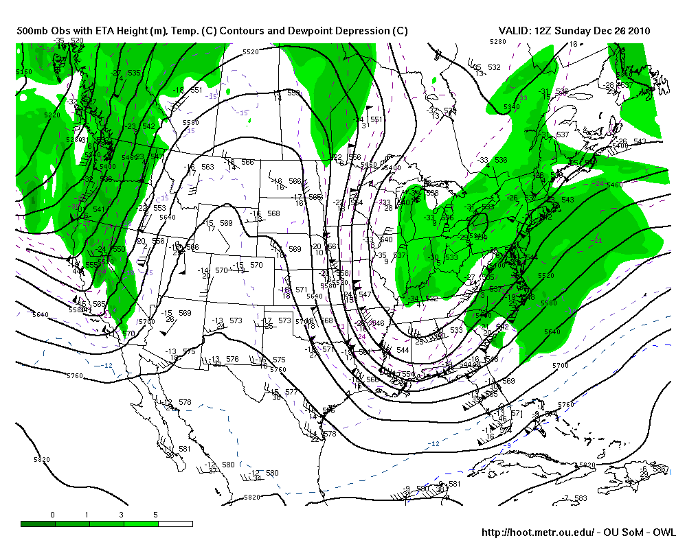
These are just a few stats at specific points, but they serve as examples of what the general weather pattern has been lately: trough in the west, ridge in the central US, and trough in the east.

Sunday (26th) morning's 500mb map from HOOT, showing a trough in the west, a ridge over the Rockies, and a trough in the east.
This pattern is often conducive to rainy and/or snowy weather along parts of the West Coast, mild and dry weather in the Plains, and cold and snowy weather along parts of the East Coast. This pattern has some relation to La Niña, which I won’t get into in this post (see this post for how this compares to an El Niño pattern from earlier this year).
However, it looks like the atmosphere is ready for some change in the new year.
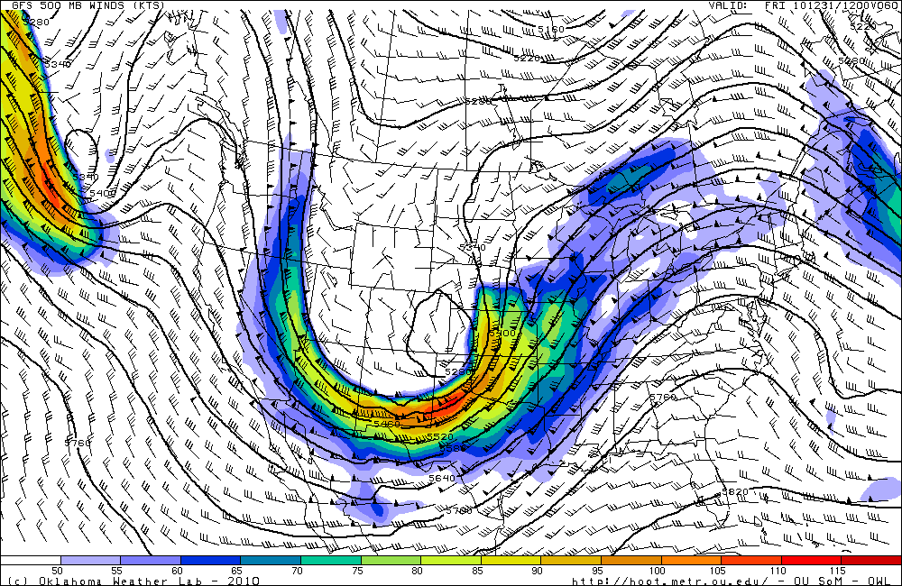
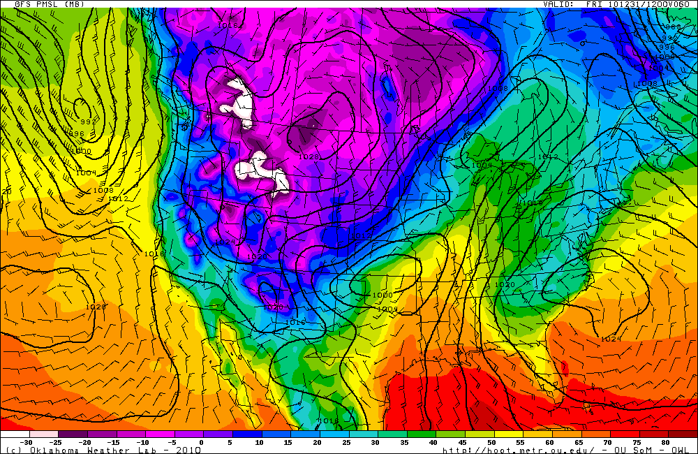
The ridge has been weakening for the last couple of days and moving eastward, which will allow a large trough to deepen and dig in over the western and central US. This will open the door for cold air to surge down into the Plains, and, with the assistance of some upslope winds, will finally allow Denver to receive several inches of snow.

GFS 500mb forecast (from HOOT) for 12Z on New Year's Eve (i.e., morning of the 31st). Compare to the 500mb map from Sunday (above).

GFS surface analysis forecast (temperature is color-coded) for 12Z on New Year's Eve. Note the cold air in the western US and the low pressure system over Oklahoma that will move up to Minnesota the next day.
Will we continue to see ridges over the West and troughs (and colder weather) over the central US? Will this just be the beginning of the atmosphere breaking out into a more progressive pattern?
We’ll have to wait and see!
For the latest on my weather and blog updates, follow me on Twitter and/or Facebook.
Green Sky Chaser » 2010 Weather Summary said,
December 31, 2010 at 8:07 am
[…] Pattern change in the works…cool and rainy/snowy West, mild and dry Plains, and snowy East begins to turn into mild and dry West and cold and snowy Rockies and Plains […]