09.06.10
Posted in Tropical Weather, Weather News at 3:51 pm by Rebekah
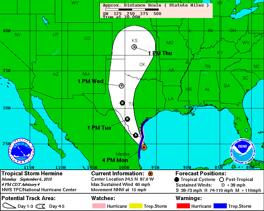
The 8th named storm of the Atlantic hurricane season formed early this morning, Tropical Storm Hermine. Hermine will make landfall near Brownsville, Texas late tonight.
Hermine will then degenerate into a depression and travel up through Oklahoma. This will just mean more rain and thunderstorms on the way soon for Texas and Oklahoma.

Permalink
09.03.10
Posted in Weather News at 4:46 pm by Rebekah
Today let’s take a very brief look at what the weather’s doing around the country.
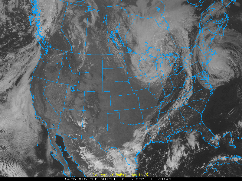
Visible satellite image from today, at 4:45 pm EDT, courtesy of College of DuPage:

You can see Category 1 Hurricane Earl off the New England coast, a low pressure system bringing clouds and rain to the Midwest, and clouds along a front from New York to Texas.
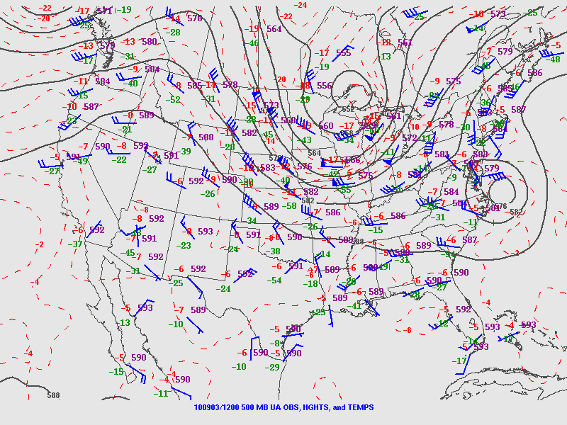
500-mb map from this morning, from the SPC:

Note the ridge over the West, bringing clear skies. The trough over the Midwest is associated with the low, and you can also see Hurricane Earl at this level. This trough is what’s going to push Earl back towards the East, although he may recurve a bit back up into Canada.
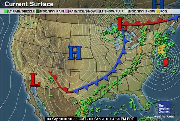
Surface map, from The Weather Channel, from 5pm EDT:

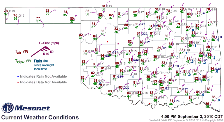
Here you can see the low pressure, high pressure, Earl, and the cold front. This cold front moved through Oklahoma last night, finally bringing us some much needed thunderstorms and cooler weather. Today has been very pleasant. See the surface map below, from 5pm EDT / 4pm CDT, from the Oklahoma Mesonet:

Permalink
09.02.10
Posted in Tropical Weather, Weather News at 4:48 pm by Rebekah

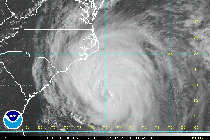
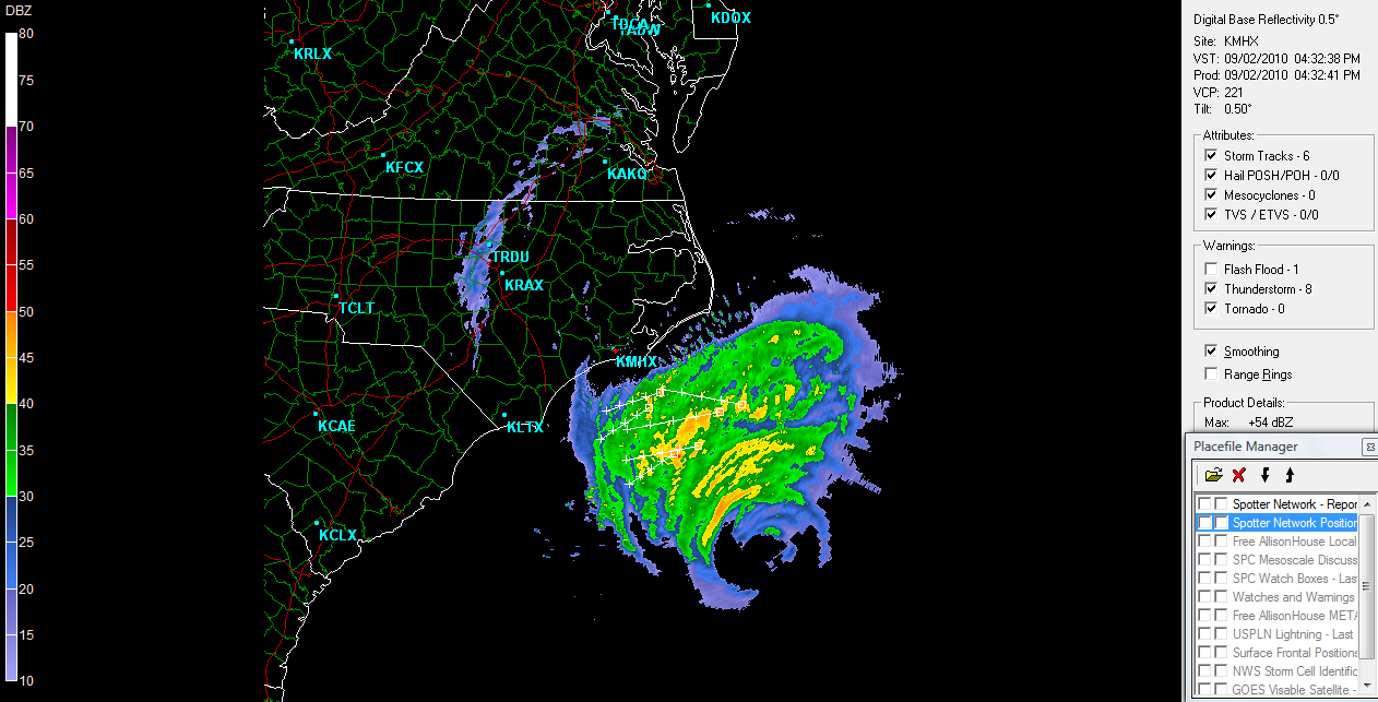
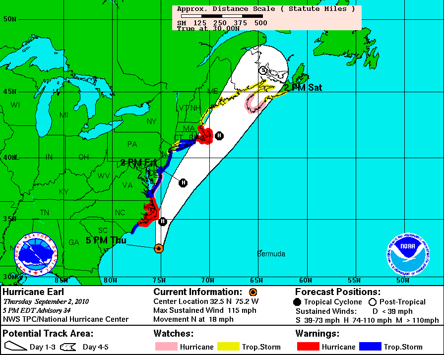
Hurricane Earl sets his sights on the mid-Atlantic Coast tonight, brushing past the Outer Banks of North Carolina as a weakening Category 3 storm. Winds are currently 115 mph, with a minimum pressure of 947 mb.

Latest NHC track for Earl:

I’m off to chase some storms (with other researchers from the National Severe Storms Lab) developing along a cold front moving through western Oklahoma, hence the short message. We’ll be launching balloons into the storms, with instruments that will measure electric field, temperature, relative humidity, winds, and pressure, as well as take images of particles (ice, rain, etc.) within the clouds.
Permalink
09.01.10
Posted in Non-US Weather, Tropical Weather, Weather News at 5:04 pm by Rebekah
While the U.S. is concerned with what will happen to the East Coast when Category 4 Hurricane Earl passes by (starting tomorrow), as well as what will eventually happen with newly formed Tropical Storm Gaston, another hurricane is just now making landfall at Seoul, South Korea.
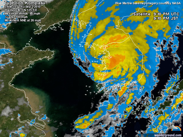
Typhoon Kompasu’s eye is coming ashore, with maximum sustained wind speeds estimated at 85 mph (Category 1 on the Saffir-Simpson scale) and a minimum central pressure of 975 mb.

Infrared satellite image of Typhoon Kompasu making landfall, courtesy of Weather Underground.
As of the time I write this post, the pressure is still dropping at Seoul and the wind speeds are still climbing. At the top of the last hour, Seoul recorded rain, winds of 43 mph, gusts to 63 mph, and a pressure of 992 mb. For the latest observations, see the Weather Underground weather history page for Seoul.
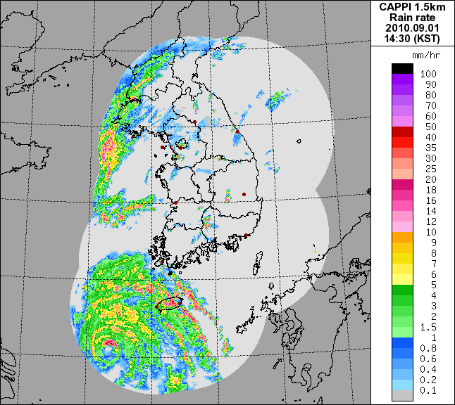
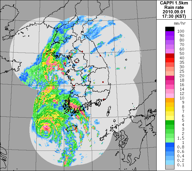
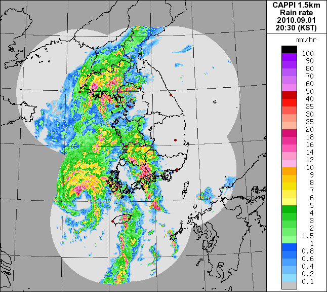
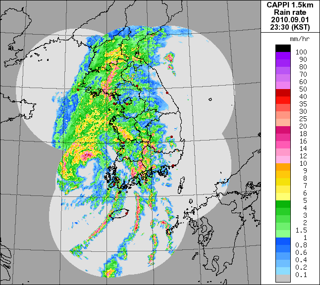
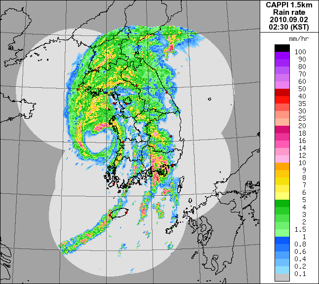
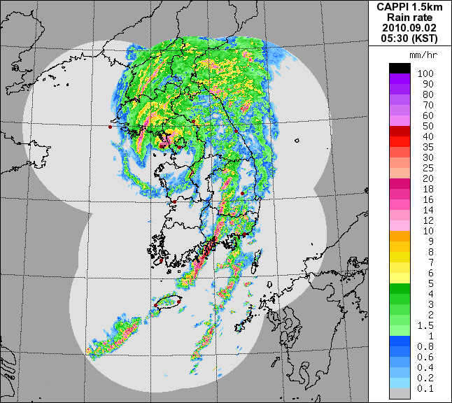
Here is a series of radar images from the Korean Meteorological Administration (weather service for South Korea) over the last several hours, showing Kompasu approaching Korea and making landfall.


Kompasu will weaken further over land and will be steered out towards Japan.
For the latest Korean weather information, see the Korean Meteorological Administration and Weather Underground.
Permalink
08.31.10
Posted in Tropical Weather, Weather News at 9:47 pm by Rebekah
This week’s post in the global weather and climate series features Cape Hatteras, North Carolina.

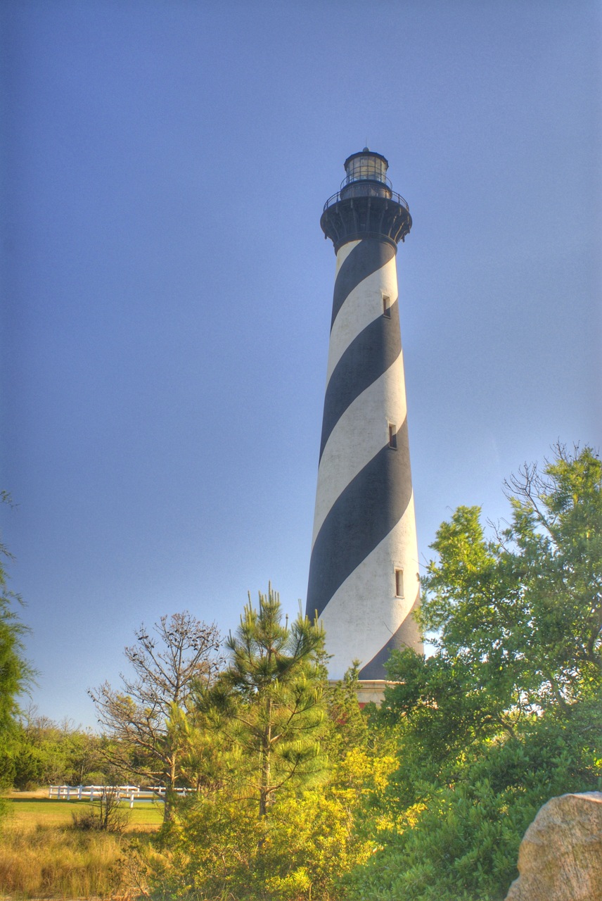
Cape Hatteras Lighthouse, Hatteras Island, North Carolina. Courtesy of Wikipedia.
Cape Hatteras is the point that just about sticks out the farthest along the North Carolina coast. On Hatteras Island in the Outer Banks of North Carolina, Cape Hatteras is most famous for its 208-ft-tall lighthouse, built in 1870. Cape Hatteras is also sometimes known as the “Graveyard of the Atlantic”, as so many ships have been lost there. The nearest town to the lighthouse is Buxton, an unincorporated community of nearly 1,500 people.
The Outer Banks is a 200-mile-long barrier island chain off the North Carolina coast. The islands are very narrow but separate Currituck Sound, Albemarle Sound, and Pamlico Sound from the Atlantic Ocean. The Wright brothers’ first flight took place from the Outer Banks, at Kill Devil Hills near Kitty Hawk, on the northern side of the island chain. Ocracoke Island, just southeast of Hatteras Island, was the home of the famed pirate Blackbeard (as well as the location of his death). The islands are highly prone to hurricanes; in September 2003, Hurricane Isabel’s storm surge washed out part of Hatteras Island.
A few more facts about Cape Hatteras (average weather data from Climate Zone, records from NWS):
- Time zone: Eastern Standard Time (UTC-5) or Eastern Daylight Time (UTC-4)
- Elevation: at sea level
- Climate zone: Temperate
- Average high temperature: 69 °F (21 °C)
- Average low temperature: 55 °F (13 °C)
- Record high temperature: 96 °F (36 °C)
- Record low temperature: 6 °F (-14 °C)
- Average annual precipitation: 56.1 inches (1,425 mm)
- Average annual snowfall: 1.9 inches (48 mm)
Current weather: In case you hadn’t guessed, I picked Cape Hatteras this week because Hurricane Earl is about to deal a glancing blow to the Outer Banks Thursday night/Friday morning. The last time I picked a North American City, Hurricane Alex was about to make landfall just south of Brownsville.
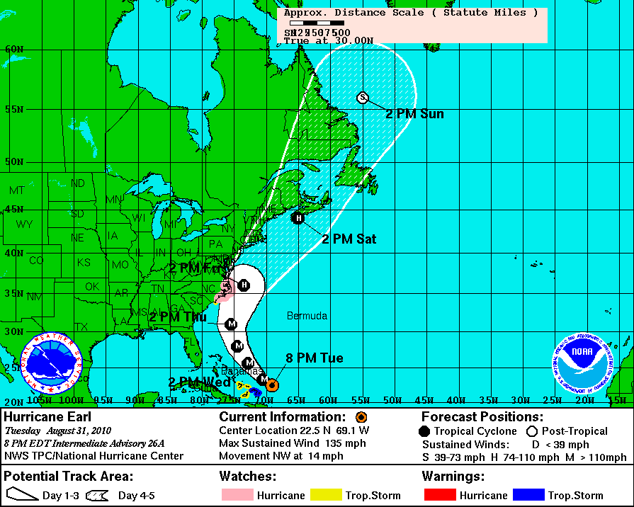
Earl is currently a Category 4 hurricane, moving northwest at 14 mph, with estimated maximum sustained wind speeds of 135 mph and a minimum central pressure of 940 mb. Here’s the latest National Hurricane Center forecast track for Earl (click to enlarge):

A hurricane watch was issued today for the Outer Banks, meaning hurricane conditions are possible and tropical storm conditions are expected to begin within 48 hours. Specific hazards mentioned in the watch include storm surges of 3 to 4 feet at Ocracoke Island and 1 to 2 feet elsewhere, hurricane-force winds (greater than 74 mph), and a high chance for rip currents as breaking waves may reach 15 feet. North Carolina officials announced tonight that an estimated 5,000 tourists have been ordered to evacuate Ocracoke Island (the only way to leave is by ferry), though year-round residents may choose to stay (estimated 800 residents).
Effects from the hurricane are anticipated to begin sometime Thursday afternoon.

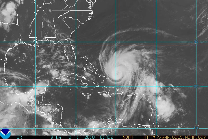
Hurricane Earl approaches the U.S. GOES infrared satellite image courtesy of NOAA. Click to enlarge.
For weather maps and information on current and forecast Cape Hatteras weather, see the Newport / Morehead City National Weather Service site. For the latest hurricane intensity and track information, as well as hurricane satellite images, see the National Hurricane Center.
For more information on Cape Hatteras, here’s a link to Wikipedia. For information on the Outer Banks, here’s another link to Wikipedia.
Next Tuesday I plan to take a look at the climate and weather in another part of the globe. As always, if you have any comments or suggestions for future cities, please leave a comment on this post!
Permalink
« Previous Page — « Previous entries « Previous Page · Next Page » Next entries » — Next Page »
