01.26.10
Posted in Weather News at 8:12 pm by Rebekah
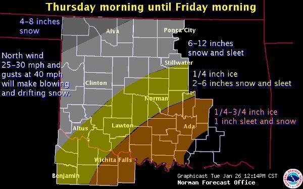
This week the National Weather Center is buzzing with talk of the winter storm Oklahoma is expecting Thursday and Friday. I am not looking forward to experiencing yet another ice storm, but it will be interesting to see just how this one pans out. Initially the models seemed to show that we might get a bit of snow in central Oklahoma, but now there is concern that the low to mid-levels may warm up enough to where we get a significant ice event. Right now the National Weather Service is predicting that Norman will get about 1/4″ of ice and 2-6″ of sleet and snow! It looks like a sure bet that classes will be canceled on Friday and probably Thursday as well. Stay tuned.

Regarding last weekend’s severe weather, there were a number of high wind reports that verified the slight risk for severe weather that SPC issued, but no tornadoes. I believe there was enough shear, but I don’t think that the instability was great enough to create strong enough updrafts for large hail and tornadoes.
On a side note, I’ve decided to get back to learning more programming. It’s something I’ve dabbled in from time to time, but I’d like to keep up with practicing as much as possible. I’ve got some working knowledge of C and Perl, but I’m also trying to learn Python and Visual Basic, the two key languages used in programming GIS software.
Permalink
01.21.10
Posted in Weather News at 11:54 pm by Rebekah
Last semester when I took Weather Briefing, a 1-credit, 3-day-a-week discussion of weather maps, occasionally my fellow classmates and I would get into a bit of trouble with our instructor for calling the weather “boring” when it was our time to lead the weather discussion. There’s always something going on in the weather world, somewhere on the planet! =) Today, the weather in the U.S. is far from boring.
There is so much to talk about, it’s difficult to know where to start. A 977-mb low continues to hammer California, as the fourth low-pressure system has come ashore at San Francisco. A potent trough assisted in the deepening of the low earlier today. The jet stream is now in a solid El Niño pattern, taking storms on a west-east track across the southern U.S. It’s raining along most of the California coast and Arizona and snowing in the Sierra Nevada and southern Rockies. I imagine all the rain is a result of a combination of a number of a factors: the low, the fronts (occluded front alon the coast, warm front in southern Arizona), a large amount of positive vorticity advection in southern California and southern Arizona, and the fact that these are coastal storms being lifted up coastal mountain ranges. Despite the recent drought, California is certainly not lacking in moisture right now.
There was also enough instability and wind shear combined with the strong lifting in order to produce several tornadoes today, around Santa Barbara, the California/Arizona border, and near Phoenix. There were also a couple of tornadoes today around Huntsville, Alabama, associated with the other low in the U.S. that assisted in bringing some lovely thunderstorms to Norman last night. There’s plenty of instability and lift out there as well, but as I’ve often seen with winter thunderstorms, the thermodynamics and the dynamics didn’t line up very well so the area of greatest shear was displaced from the area of greatest instability and lift. I think this must be a significant reason as to why there were just a few weak tornadoes, rather than any strong tornadoes.
The California system will make it out to the Missisissippi River valley and Gulf Coast in a few days, bringing a chance for more severe weather and potentially some weak tornadoes again. I haven’t looked at that forecast in much detail yet, but that will have to wait.
The Dallas Stars just lost to the Vancouver Canucks, in Vancouver–it was a sad ending, as Dallas was tied at 2 for a while before Vancouver got two goals in the third period. Dallas came back to score one more goal with just 2.8 seconds left, but it was too little, too late. They lost 3-4. The Stars are the only hockey team we get on TV here, so I’ve decided they should be my favorite hockey team (as I didn’t become very interested in hockey until a few years ago, sadly). On a much brighter note, the Mariners signed Felix Hernandez (my favorite Mariners pitcher for several years–he’s their ace now) to a 5-year contract extension, through 2014! The Mariners continue to make great moves in an attempt to finally become a playoff contender again.
Bring on the spring: storm chasing and baseball!! =D
Permalink
01.17.10
Posted in Weather News at 9:25 pm by Rebekah
The jet stream has recently shifted from its meridional (north-south) pattern to more of a zonal (west-east) pattern, preventing the cold air up in Canada from diving south and allowing much of the U.S. to warm up a bit.
This weather pattern also means more coastal storms for the West Coast, especially California.
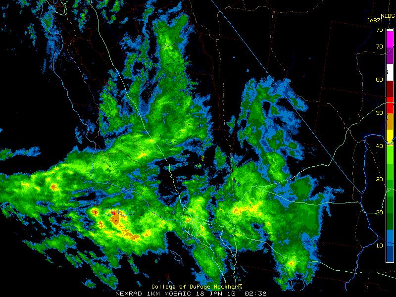
Take a look at the following radar image of southern California this evening (6:38 pm Pacific Time).

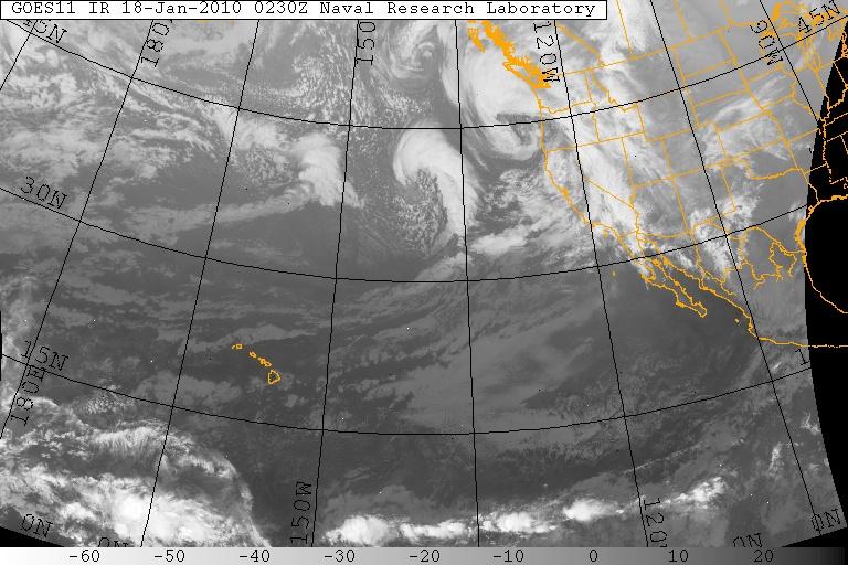
Now look at the following infrared satellite image over the Pacific Ocean, showing a few more storm systems (extratropical cyclones) heading eastward.

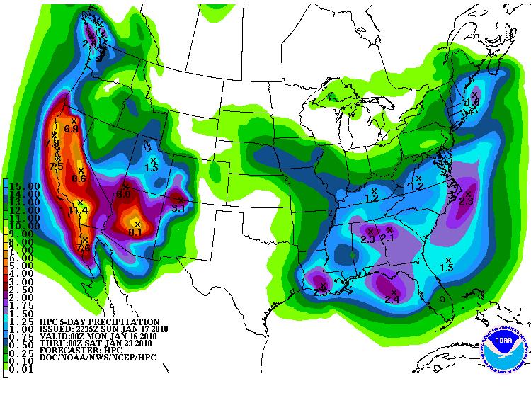
How much rain may be in store for the coast? The Hydrometeorological Prediction Center (HPC) is predicting just over 11 inches between Los Angeles and San Diego just from tonight through Friday night (below)! Shortwave troughs embedded within the flow of the jet stream are responsible for much of the expected rain (and snow in the mountains). Upper-level divergence is found downstream of a trough, causing and/or enhancing upward motion and the development of low-level convergence (hence a surface low pressure system). These shortwaves are also going to bring thunderstorms (potentially severe!) to eastern Texas on Wednesday.

Albert Hammond was right when he sang, “It never rains in California, but girl don’t they warn ya. It pours, man it pours.”
Permalink
01.05.10
Posted in Weather News at 1:17 pm by Rebekah
So says the National Weather Service, Norman OK forecast office!
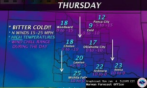
The statement, copied and linked below, states Oklahoma is expecting the coldest temperatures in a decade! The weather forecast is calling for highs in the teens, lows near or below zero Thursday/Friday, with wind chills as low as -20F!! Time to stay inside, curled up on the couch with some hot cocoa and my cat.
I’m sitting at the Tri-Cities, Washington airport at the moment, about to fly to Salt Lake City, and then on to Oklahoma City. I can’t say that I’m looking forward to being greeted by an arctic airmass, and some of the coldest temperatures (or at least wind chills) that I’ve ever experienced, but maybe it will allow my cat and I to spend some quality time inside together. 🙂
Here’s the statement:
Get Ready for the Extreme Cold!
The National Weather Service is forecasting the coldest air we’ve seen in more than a decade. It arrives late Wednesday and will be here into the weekend.
It is likely that many places will see wind chill values (how cold it actually feels when you combine temperatures and the wind) at or below zero continuously for 18 to 24 hours or more.
Here are some links with more information on the expected cold snap and how you can stay safe and informed:
What’s expected and how to prepare – Statement from NWS Norman
Will we break a record? – Statement from NWS Norman
Wind Chill Index – General Information
Wind Chill Index – Frequently Asked Questions
Staying Safe in Extreme Cold – CDC Guide
How to make your own customized hourly forecast
NWS Norman Enhanced Web Page


Permalink
01.03.10
Posted in Weather News at 3:13 pm by Rebekah
Under the grip of an unusually cold airmass for this time of year, much of the eastern US is experiencing temperatures remain well below average.
The National Weather Service recorded a temperature of -38 °F at Grand Forks, North Dakota early Saturday morning; factoring in winds of 8 mph when the air temperature was -36 °F (winds were calm when the temperature was at its coldest) yields a wind chill of -58 °F (-50 °C)!!
International Falls, Minnesota set a record temperature of -37 °F early Saturday, only to tie it early this morning! The NWS is currently predicting a low of -33 °F in International Falls tonight, so there is a chance they will tie that new record again, if not break it.
Lake-effect snow continues across the Great Lakes, and heavy snow continues throughout the New England area as the 978 mb low-pressure system off the Northeast Coast refuses to show signs of going anywhere fast.
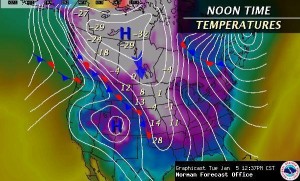
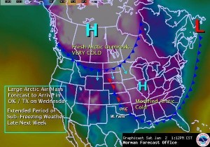
An even colder arctic airmass will quickly surge southward along the Rockies into the Plains Tuesday night through Wednesday. I fly back to Oklahoma on Tuesday and it looks like I will get there just in time to experience perhaps some light snow along the cold front Wednesday night and the coldest temperatures of the season so far Thursday night/Friday morning (8 °F with wind chills as low as -10 °F). Brr! I can’t say I’m a fan of the cold weather; Oklahoma weather is just about right for me, as the area gets just enough cold weather and wintry precipitation to keep me happy, but not so much that I get tired of it (a little more snow from time to time would be nice, though–but I missed the big Christmas Eve Blizzard!).

NWS graphic forecast of arctic blast on Wednesday.
Permalink
« Previous Page « Previous Page Next entries »
