Target Area: Enid/Blackwell, Oklahoma
Chase Area: Enid, Oklahoma area
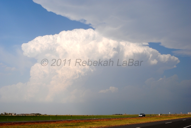
Observations: two supercells, mammatus, and lightning
Distance: 415 miles
Time: 8 hours, 30 minutes
Chase Team: Jeff Makowski and myself
SPC Convective Outlook: Slight Risk (Click to see SPC products, data, and storm reports)
Chase Setup: A strong trough was digging into southern California, while weak ridging was going on over the Plains. Despite the ridge, strong flow aloft combined with a stationary front along the Kansas/Oklahoma border and a dryline through western Oklahoma was expected to create enough lift to spark a few storms. Dewpoints were in the upper 50s in south central Kansas and in the lower 60s in northern Oklahoma. CAPE was around 3000 J kg-1 and storm-relative helicity was about 150 m2 s-2.
Blog Entries:
Storm Chase #2: Waiting Game (during)
Chase #2 Review (after)
Chase Log: This was kind of an iffy day, with the big question being if there would be enough lift to get storms going. We decided to chase north central Oklahoma and wound up playing a bit of a yoyo game between two supercells.
We first got on a storm just as it began to form, south of Enid. We followed the developing supercell for a little while, before heading off to chase the more beautiful-looking storm to our northeast, in Kay County. We figured it may have been closer to a boundary that might allow for better rotation and a more sustainable updraft.
Once we got closer to the Kay County storm, we decided to turn around and head back south again, as our first storm had begun to show signs of tightening rotation. This could have been a mistake, but the northern storm wasn't looking any better, and both storms looked pretty ugly on radar.
Shortly after making the decision to go south and meet up with the approaching southern storm, the northern storm was tornado-warned, of course! Someone reported a tornado up there, but it was too late for us. A funnel cloud had been reported anyway with the southern storm, so we continued on.
The southern storm was starting to cross I-35, and with the bad road networks east of the freeway, we decided to try to keep well out ahead of the storm, which cost us the chance to see any of the large hail that some chasers witnessed, or any rotating wall clouds from up close.
I still had fun for an early season chase, but there were a few things we could have done differently. However, it was a tough day in terms of first deciding a target area, and then deciding a storm, and then deciding the best roads in not-very-good chase territory (east of I-35, anyway).
 |
Kay County supercell |